Spring 2024
Chasing a Troubled River
The mighty Colorado River and its tributaries run through seven states and 10 national park sites and provide water and electricity to millions of people. But as photographer Pete McBride documents in a new book, the river is drying up, and the need to correct course grows more urgent every day.
I’ve known the Colorado River my entire life,” Pete McBride writes in “The Colorado River: Chasing Water.” “I grew up in its headwaters and learned to swim in alpine lakes and tributaries fed by Rocky Mountain snow.” So when he was searching for a close-to-home story to cover after two decades working as a globe-trotting photojournalist, he turned to his backyard. McBride’s father, who moved the family to a high-mountain cattle ranch in the 1970s, suggested the river project after observing how the snowpack and meltwater that nourished their land were changing. “Around 2007, I started following — quite literally — our irrigation supply as it returned to the creek and then to the Colorado River,” McBride writes. “Over the next 15 years, that personal mission would become a cornerstone for much of my life’s work.”

Climate Change Forces Difficult Decisions Along the Colorado River
Without enough water to go around, federal agencies and advocates weigh competing needs of people and threatened fish.
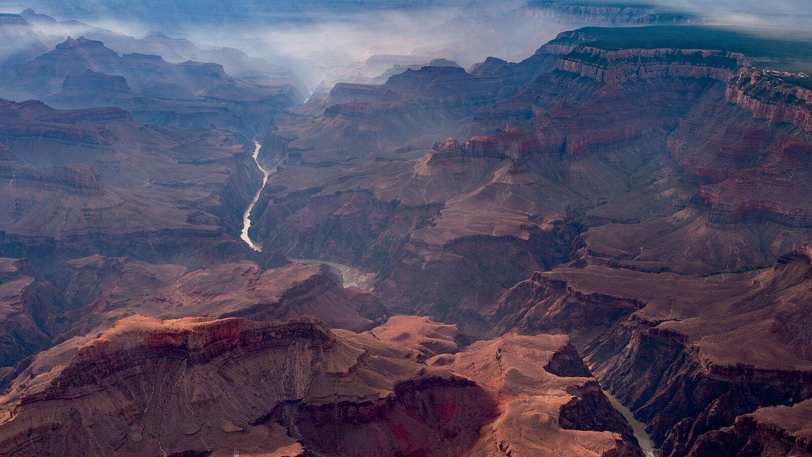
See more ›McBride writes that he has hiked, paddled, floated and flown across every mile of the Colorado’s main stem and documented nearly all the tributaries, diversions and dams of a river that originates in Rocky Mountain National Park and, among its many claims to fame, carved the Grand Canyon. In “The Colorado River,” McBride showcases a broad selection of the hundreds of thousands of images he’s captured over years of following the twists, triumphs and trials of the waterway.
In the 21st century, the story of the river is complicated and often grim. People in seven U.S. and two Mexican states depend on the river for drinking water; 30 Native Tribes also retain water rights, though in many cases, their access is limited. The river also irrigates some of America’s most productive farmland and provides hydropower to millions in the West. But experts have been concerned about overuse for more than 100 years, and water levels continue to drop as climate change fuels a 24-year megadrought and reduces the snowpack that feeds the river. Meanwhile, many municipalities and agricultural operations that rely on the river continue to expand, and a long-term agreement among states — including California, Arizona and Nevada — that would govern the distribution of water and require cuts in usage is in the works, though the outcome is uncertain. The river “is loved and litigated to the last drop — even before a snowflake or raindrop hits the earth,” McBride explains in his book.
This is one of the most predictable environmental disasters in history, said Ernie Atencio, NPCA’s Southwest regional director. “People have seen it coming for decades, but now it has absolutely hit a crisis level because of climate change,” he said. “We just can’t ignore it anymore.”
But finding solutions that meet the needs of all the stakeholders is a nearly impossible task. Which towns, cities, states, agricultural concerns, corporations or individuals should be required to reduce their water and electricity use? Are there dams, including Glen Canyon (which many environmentalists have long despised), that should be removed to redress water flow and repair riparian ecosystems? Could interventions like these allow the Colorado to once again reach the sea in Mexico?
As NPCA gears up to launch a new Colorado River campaign, it must consider both the big picture and more specific questions related to the 10 national park sites that the river and its tributaries touch. (In addition to Rocky Mountain and Grand Canyon, those include — moving roughly from headwaters downstream — Dinosaur National Monument, Curecanti National Recreation Area, Black Canyon of the Gunnison National Park, Arches National Park, Canyonlands National Park, Glen Canyon National Recreation Area, Rainbow Bridge National Monument and Lake Mead National Recreation Area.) How can NPCA support the National Park Service in producing a comprehensive vision for the parks of the Colorado River Basin? How should the Park Service manage historical objects, ancient cliff dwellings, rock art panels and other archaeological sites that are increasingly exposed as water levels drop? What should the agency do about the terrestrial ecosystems that are bouncing back as parkland that was submerged reappears? At what cost do you try to save the humpback chub and razorback sucker, threatened and endangered fish that NPCA and others have been fighting to protect in the Grand Canyon?
People have seen it coming for decades, but now it has absolutely hit a crisis level because of climate change. … We just can’t ignore it anymore.

The Beauty of Loss
Pete McBride spent 20 years photographing the Colorado River. His new book showcases the depths of its crisis — and reasons for hope.
See more ›“There will come a point very soon where we’re going to have to make some hard choices,” Atencio said.
When we ask too much of the river, it answers by disappearing, McBride writes. But he contends that for all the bony landscapes, misguided meddling and over-allocation of water rights, all hope is not lost. “I’ve witnessed collaboration and communication bring about improved efficiencies that raise flows, restore habitats, and even bring endangered fish back from the brink,” he writes. “Of course, there are a lot of rapids ahead. And seeing a resilient, equitable line through them will take creativity and teamwork. But after years of studying this American lifeline, from its snowcapped peaks to its ancient canyons and even its ghostly end, I know I’ll keep trying to testify for the magnificence and fragility of my beloved backyard river.”

The Colorado River headwaters start as snowmelt in Rocky Mountain National Park.
©PETE MCBRIDE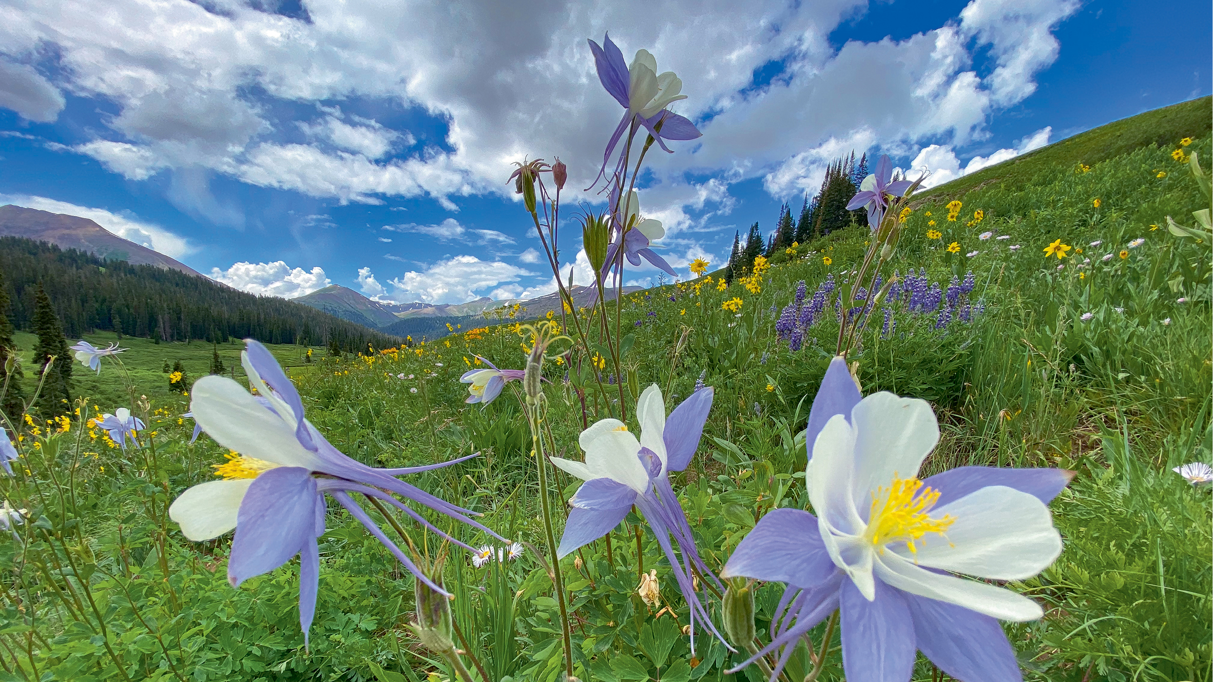
The Colorado state flower, the columbine, blooms in alpine areas of Rocky Mountain National Park.
©PETE MCBRIDE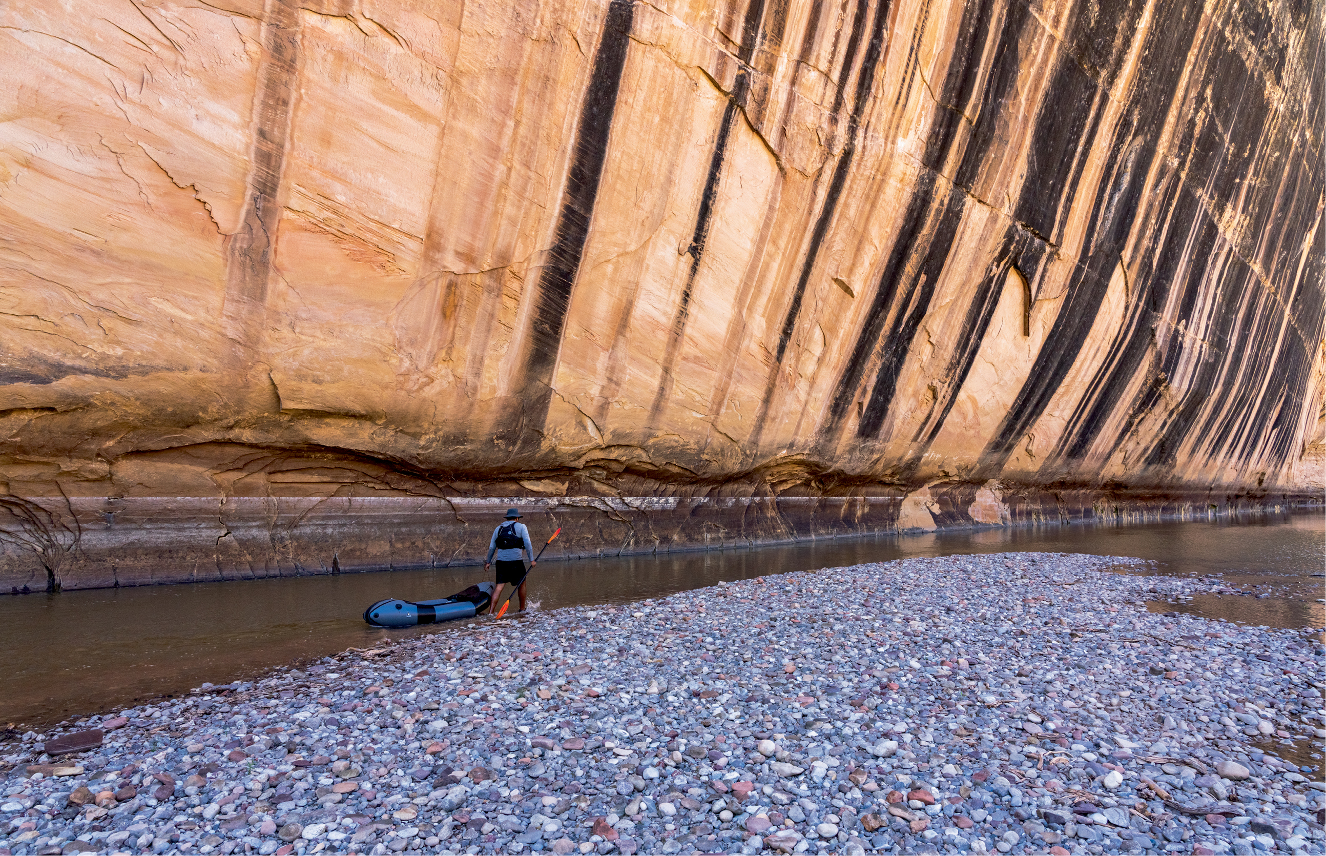
The Yampa River, which runs through the upper Colorado River Basin, had such low water levels in 2021 that McBride and his friend had to drag their pack rafts along the river for most of the 50-mile journey through Dinosaur National Monument.
©PETE MCBRIDE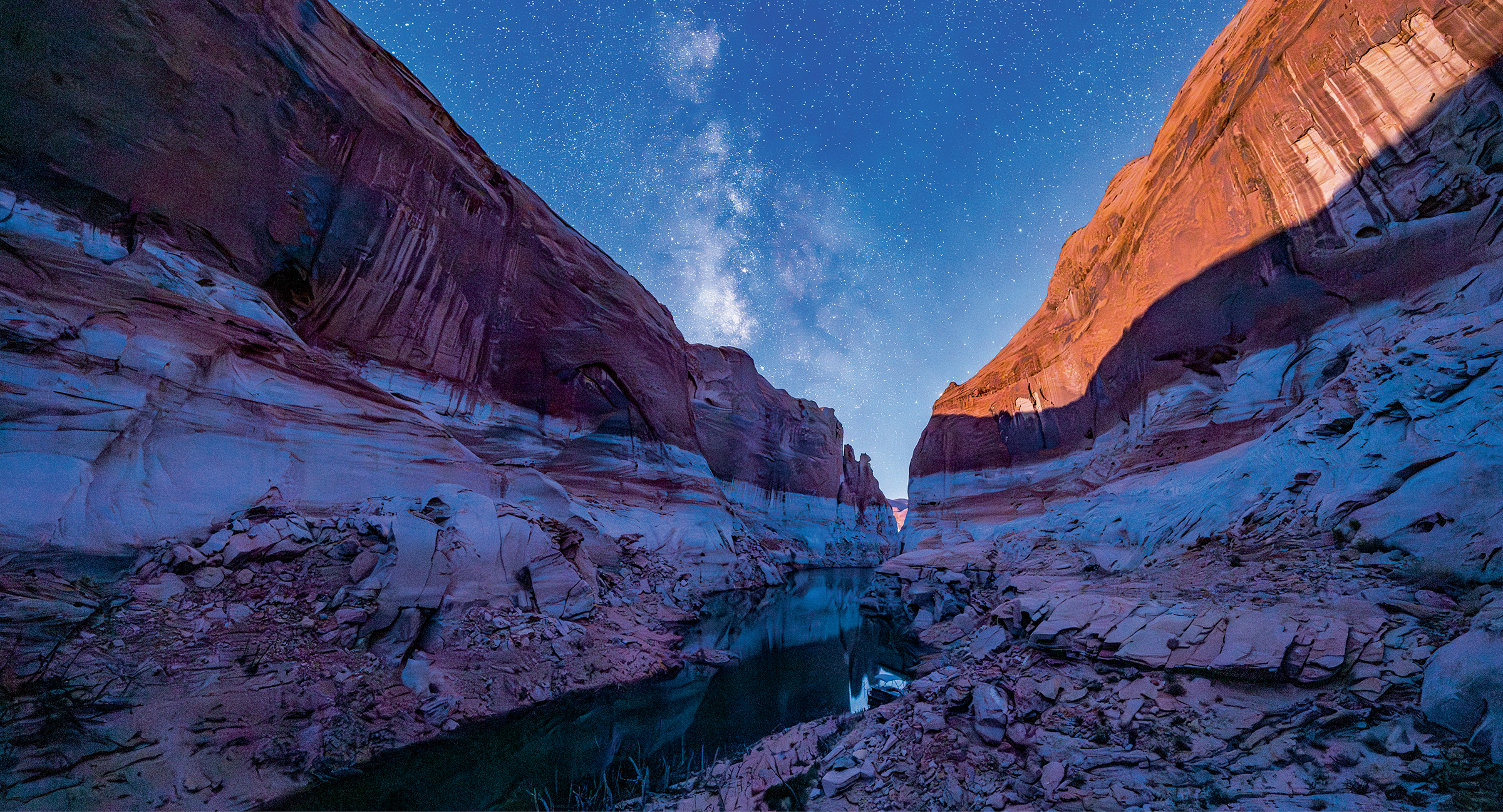
The Milky Way over Lake Powell and its waterlines, or bathtub rings, reminders of wetter times. Recent studies have shown that evaporation from reservoirs removes 10% of the river’s flow.
©PETE MCBRIDE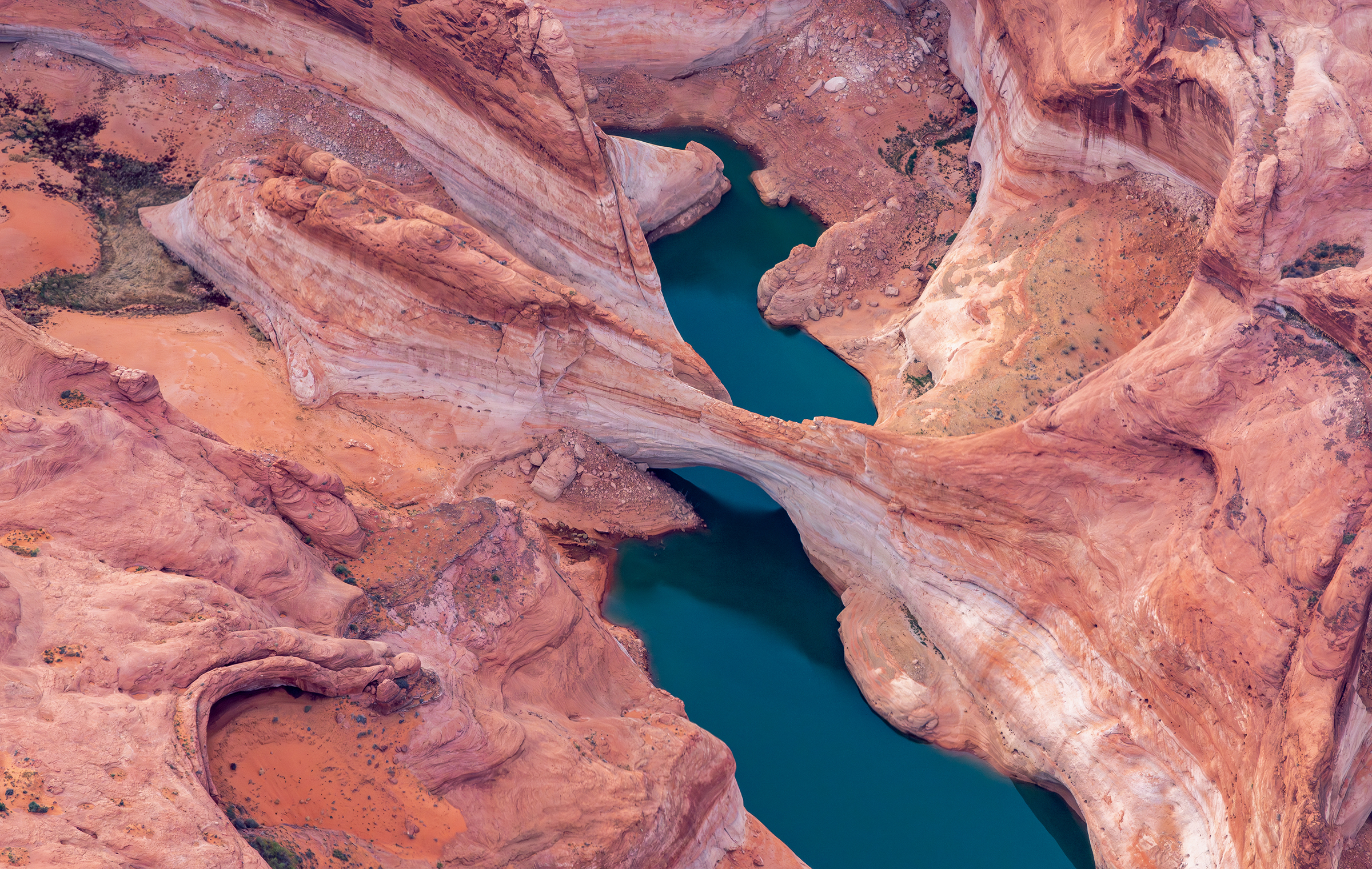
Gregory Arch in Lake Powell has been mostly submerged for the last 50 years. In 2022, boats passed under its span.
©PETE MCBRIDE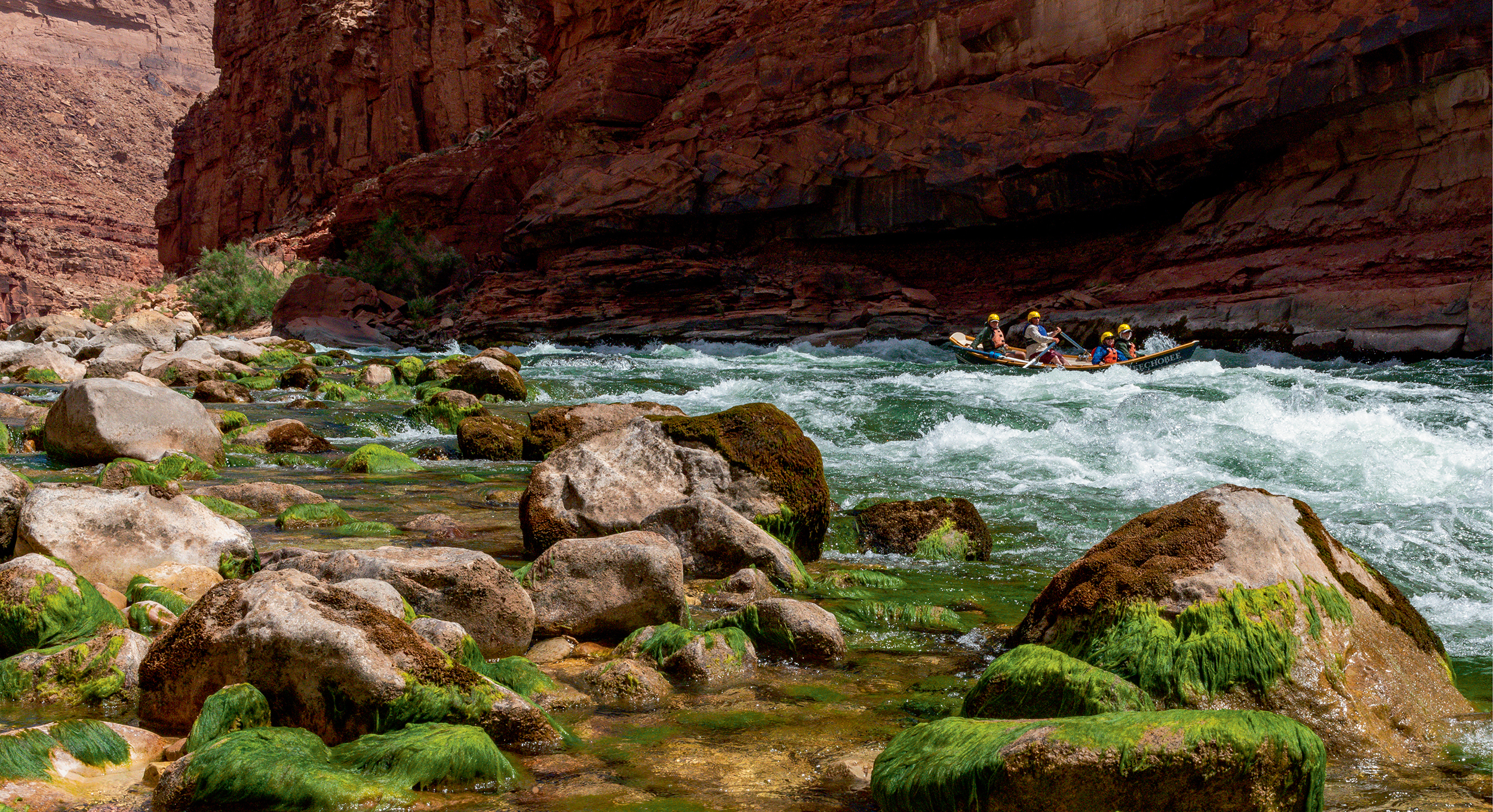
Whitewater rafting in the Grand Canyon. The park attracts nearly 30,000 annual boaters, who must pack in and out all of their supplies and trash.
©PETE MCBRIDE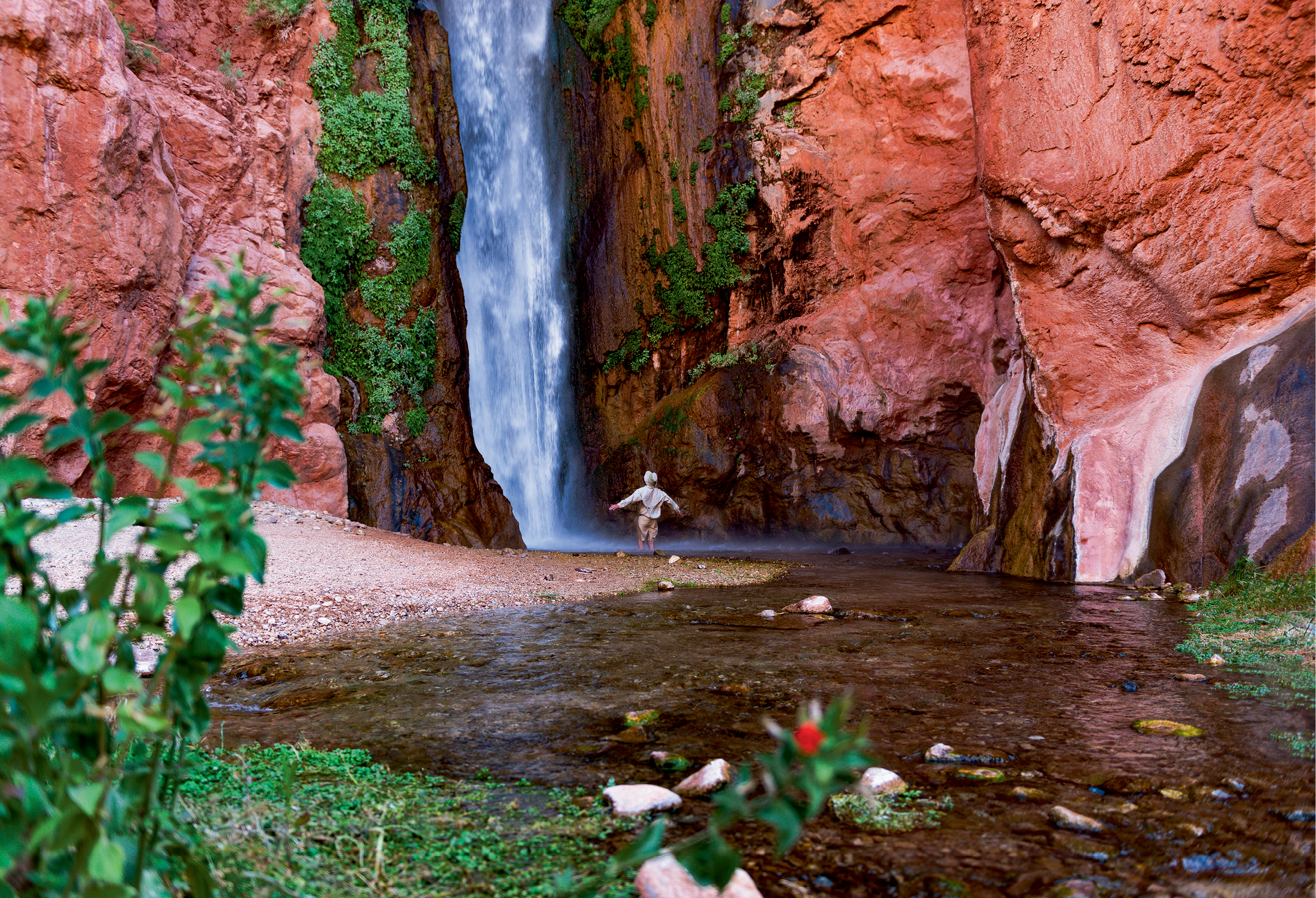
A waterfall within Grand Canyon National Park.
©PETE MCBRIDE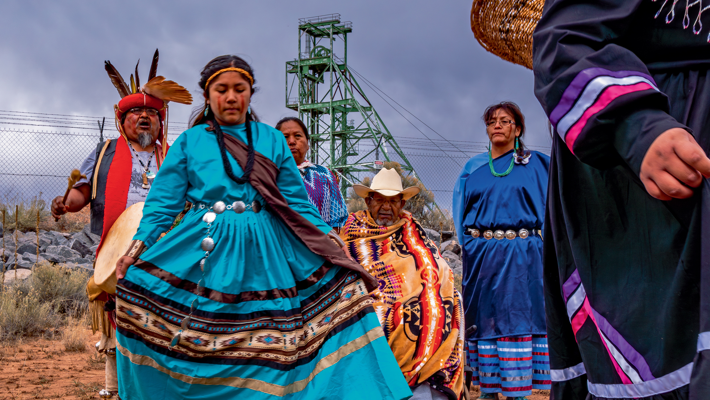
Thirty Tribes reside within the Colorado River watershed and collectively have rights to about 25% of the river, but those rights do not actually translate to water access. Here, Havasupai Tribal members protest uranium mining at Canyon Mine (now Pinyon Plain Mine), which lies within Baaj Nwaavjo I’tah Kukveni – Ancestral Footprints of the Grand Canyon National Monument. The Tribe is concerned about the danger the mine poses to the area’s aquifers and springs, wildlife, and cultural sites. Learn more.
©PETE MCBRIDE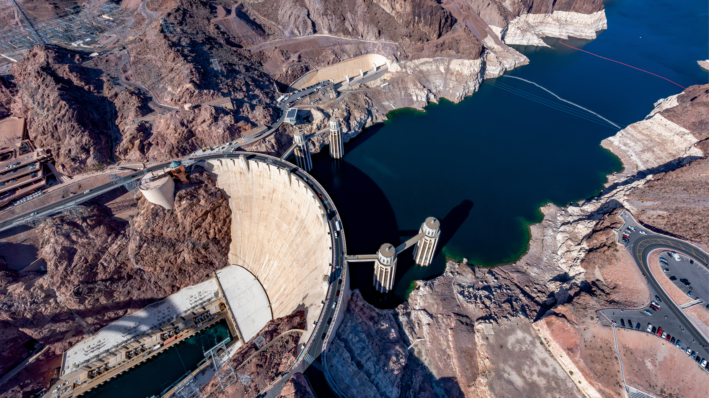
The 726-foot-high Hoover Dam was completed in 1936. At the time, it was the world’s largest dam. Today, the white bathtub ring on America’s largest reservoir shows how far the water level has dropped.
©PETE MCBRIDE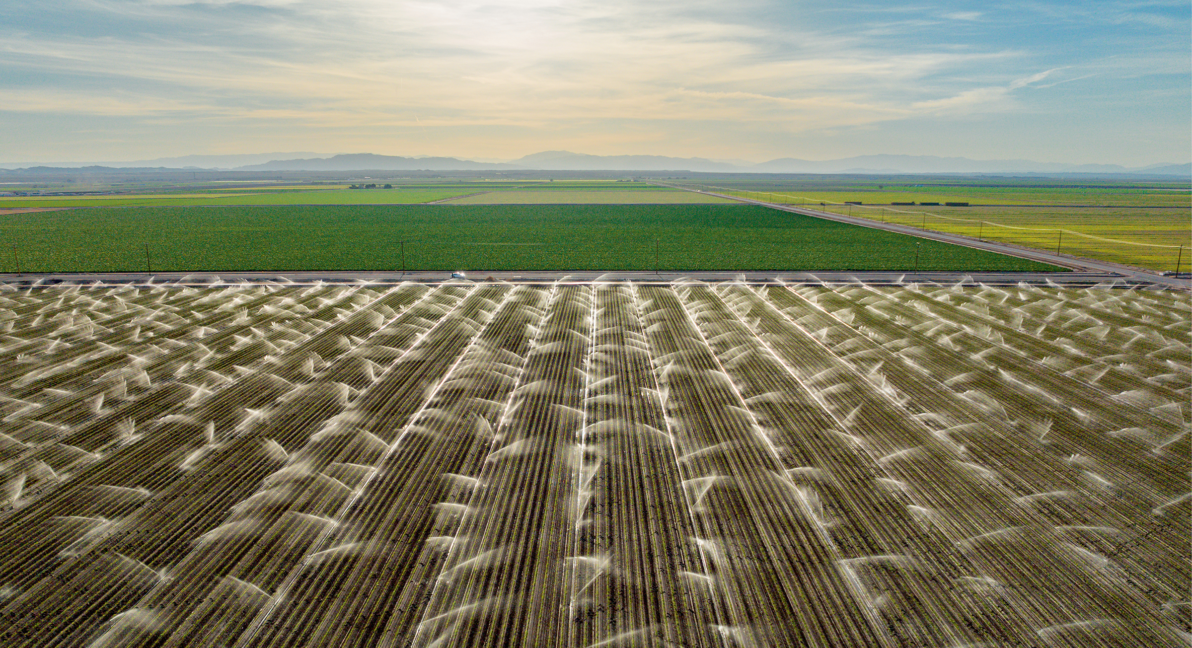
Much of the alfalfa hay grown in Southern California’s Imperial Valley and in Arizona is shipped to the Middle East and other parts of Asia. “So, while on one hand we’re living in drought and the driest, hottest times we’ve ever had around this river, on the other hand, we’re exporting that water overseas in the form of hay,” McBride said.
©PETE MCBRIDE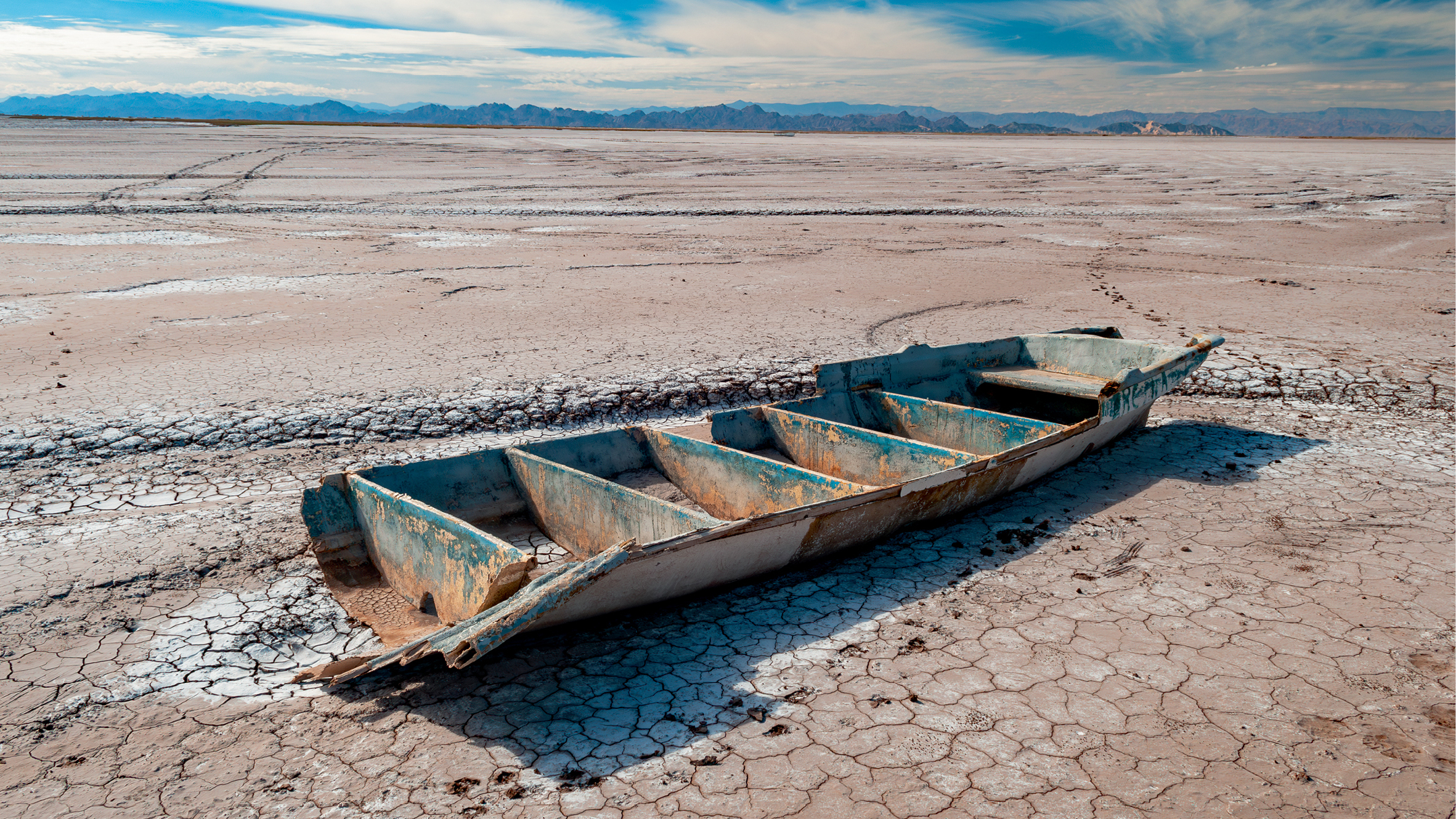
In Mexico, the historic Colorado River channel is nothing more than cracked earth. A century ago, this area was a vast estuary and bird sanctuary.
©PETE MCBRIDE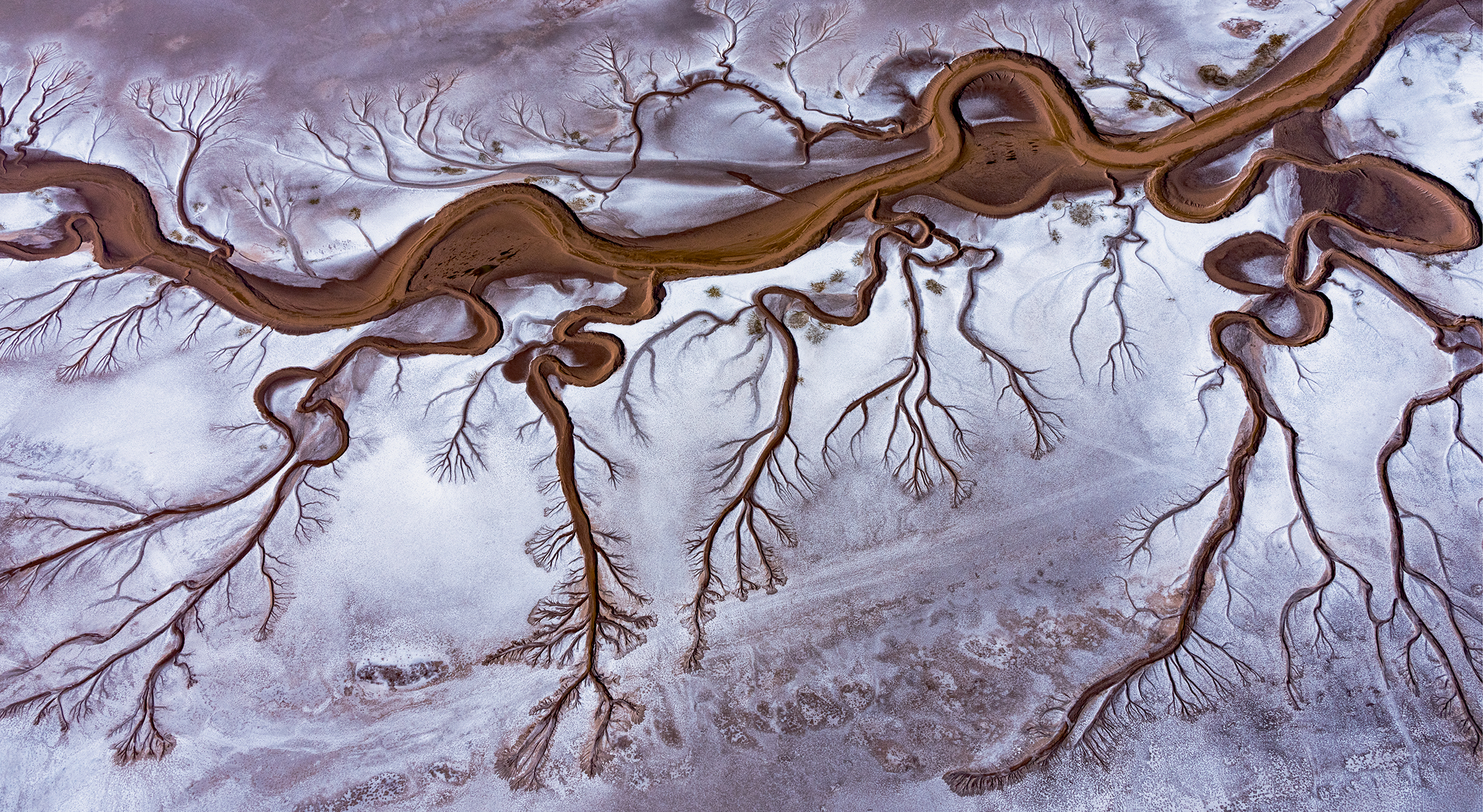
The dry, salt-encrusted Colorado River delta. Pete McBride said he was drawn to the exquisiteness of nature in photos such as this one, but he thinks readers can learn something from these images. “It’s not just normal beauty. It’s sort of a lost, dead beauty,” he said on NPCA’s podcast. The river hasn’t flowed naturally all the way to the Sea of Cortez in Mexico in decades.
©PETE MCBRIDEAbout the author
-
 Rona Marech Editor-in-Chief
Rona Marech is the editor-in-chief of National Parks, NPCA’s award-winning magazine. Formerly a staff writer at the Baltimore Sun and the San Francisco Chronicle, Rona joined NPCA in 2013.
-
Blog Post
Special Treatment Given for Mining? That’s Got to Stop
NPCA is fighting for widespread mining reform so a 19th-century law giving the mining industry first dibs on public lands stops harming the environment.

![[SPRING 2024] Colorado River 089 Potash](https://npca.s3.amazonaws.com/images/17972/26ac2984-32de-4f32-8ba0-1b69cfee42bf-original.jpg?1709225461)
![[SPRING 2024] Colorado River 186 green farm](https://npca.s3.amazonaws.com/images/17970/53d9e2a7-5904-4b0a-a310-f8b755e064aa-original.jpg?1709225165)
![[SPRING 2024] Colorado River 167 - pipeline](https://npca.s3.amazonaws.com/images/17963/134d3652-dbec-4509-aeca-62a3b47b2c86-original.jpg?1709223754)